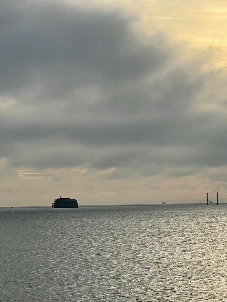
The fort in the picture is one of four built between 1850 & 1880 to defend against a threat of invasion from France. The ‘blob’ centre right is a ship at anchor, probably waiting to come in to port, probably to be unloaded. The two columns extreme right are navigation aids .
It wasn’t particularly early that I went out for a walk. On any walk, especially if you know the route, you encounter decision points, do I go this way or that? Apart from the decision of which way to go from the front door, I encountered two main decision points;
On the route, I reach what I call “The Iron Bridge”. At that point, I could have retraced partially to head down a route around a large park area, or I could head on to Clayhall lane. At which it was mainly a left or right decision. Right would take me towards Alverstoke, left down toward Haslar Hospital. I headed to ward Haslar, As usual, when I that area, I feel a need to visit the Sea Wall, from where I took this evenings picture.
At around four miles, not a particularly long walk, but it really was very nice to get out.
